Protecting the watershed
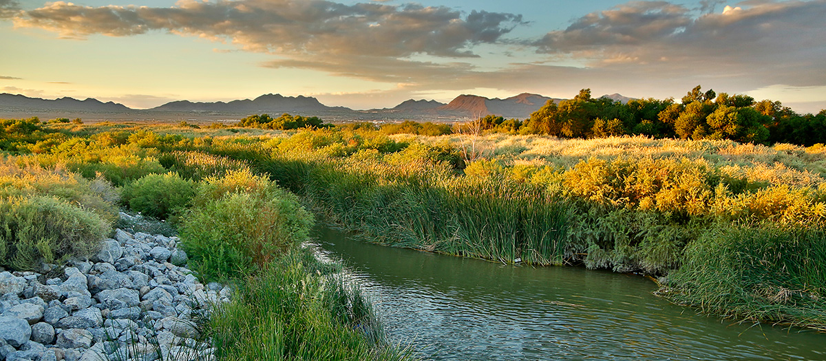
The Las Vegas Valley watershed includes Lake Mead and the valley's hydrographic basin, which measures approximately 2,200 square miles. Snowmelt in the surrounding mountains and precipitation feed the hydrographic basin, which drains into the Las Vegas Wash and eventually empties into Lake Mead.
Monitoring and management of the watershed are critical to protecting the region's overall water quality.
Las Vegas Valley Watershed Advisory Committee
Several Southern Nevada water and wastewater agencies formed the Las Vegas Valley Watershed Advisory Committee (LVVWAC) in 2007 to cooperatively address laws that govern water management practices and to protect the valley's watershed.
The LVVWAC considers all water sources in the hydrographic basin as part of the watershed. This includes Colorado River water, groundwater, shallow groundwater, urban runoff, stormwater, and treated wastewater flows.
The committee developed a Regional Water Quality Plan, which outlines the important role of local agencies to protect the Las Vegas watershed resources, including municipal drinking water supplies, wildlife habitat and recreation. The group reports on its accomplishments biennially.
In addition, the LVVWAC provides oversight and funding for the Las Vegas Wash Coordination Committee's activities to stabilize and enhance the Las Vegas Wash.
Mission and goals
The Watershed Advisory Committee set as its mission to protect, preserve and enhance the quality and quantity of water resources of the Las Vegas watershed. To achieve its mission, it developed the following seven goals:
- Protect Lake Mead as a source of water for Southern Nevada and downstream users.
- Meet or surpass federal, state and local standards and regulations.
- Preserve and enhance the natural, cultural, historic and recreational values of watershed and Lake Mead.
- Coordinate water resource management.
- Manage flood risks.
- Sustain water and energy resources for future generations.
- Build community awareness and support for regional watershed management.
Member agencies
The LVVWAC is comprised of the following Southern Nevada water and wastewater agencies:
Meetings
The LVVWAC meets virtually each April and October, with special meetings as needed.
Lake Mead water quality
The Colorado River pools behind Hoover Dam to create Lake Mead, the largest reservoir in the United States.
The lake is the source of nearly 90 percent of Southern Nevada's water, and it is under constant scrutiny to ensure the quality of the water.
The Nevada Division of Environmental Protection established the Lake Mead Water Quality Forum to protect public health and preserve the water quality of the Las Vegas Wash, Las Vegas Bay, and Lake Mead.
Thermal stratification
During warmer months, the lake's top portion of water heats up faster than the deeper portions, causing a distinct layering of water, or thermal stratification. Separating warm and cold water, thermal stratification protects the deeper layer of water by forming a natural barrier that keeps organisms and pollution near the surface.
Located at the same depth as the intakes, the deeper layer of water also is of better quality.
Destratification—the breakdown of these layers as the water becomes isothermic, or one temperature throughout—can occur in the winter, increasing the possibility of pollutants traveling near the intakes.

Intake 3 ensures Southern Nevada's access to its primary water supply if lake levels continue to decline due to drought conditions. It also protects municipal water customers from water quality issues associated with declining lake levels.
Lower Colorado River water quality monitoring
The Lower Colorado River Regional Water Quality Database contains more than 2 million records covering nearly 1,000 parameters including depth, temperature, pH, conductivity, dissolved oxygen, nutrients, metals, and organics.
Information in the database is provided by SNWA, City of Las Vegas, Clark County Water Reclamation District, UNLV, Bureau of Reclamation Denver, Bureau of Reclamation Lower Colorado River, City of Henderson, Metropolitan Water District of Southern California, Clark County Regional Flood Control District, Colorado River Regional Sewer Coalition, Central Arizona Project, and Nevada Division of Environmental Protection.
Email us for access to the Lower Colorado River Regional Water Quality Database.
Water samples are drawn from the lake every week to determine if there is a presence of fecal coliforms, E. coli, and perchlorate. The tests also determine the level of:
- Dissolved oxygen
- pH level
- Conductivity
- Temperature and turbidity
- Nutrients